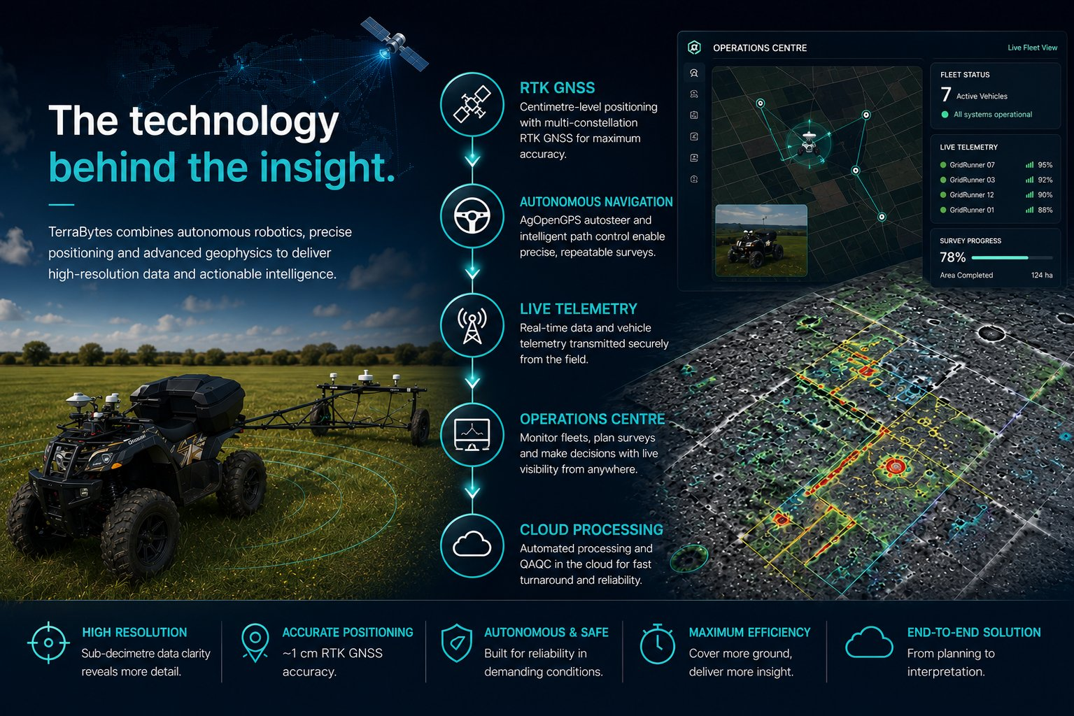
GridRunner autonomous survey platform
GridRunner is a ground-based all-terrain autonomous system capable of carrying and towing geophysical instruments across large areas with controlled speed and centimetre-level positioning.
- RTK GNSS guided navigation
- Remote monitoring and control
- Live status from vehicle and instruments
- Designed for repeatable coverage and scalable operation
One integrated survey system
Each part of the platform feeds the next — acquisition, monitoring and processing are designed together, not bolted on.
Autonomous acquisition
Repeatable lines, controlled speed and consistent positioning across large survey areas.
Operations Centre
Live view of vehicle location, RTK quality, instrument status, coverage progress and alerts.
In-house processing
R-12 produces structured geophysical outputs, QA records and final data packages.
 Live telemetry
Built to be watched while it works
The Operations Centre exposes the live state of every connected system, so positioning, logging and instrument health are visible during acquisition rather than reconstructed afterwards.
Explore the Operations Centre →